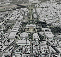
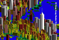
 My friends and I have worked on 3D building model construction with aerial photogrammetry technology in past years and we have created large amount area of 3D building data (8000+ sq km), covering dozens of the US and international cities since 2000.
To create 3D building models, we designed a set of sophisticated digitization guidelines for aerial stereo plotter operators to instruct them how to and what feature points should be collected to minimize digitization work. For example, for a building with dome shaped rooftop, the digitization guideline requires the operator to collect only four feature points: because an operator could not see the dome center from the stereo-plotter’s optical 3D model, the guideline instructs them to collect 3 points on bottom circle with at least 60 degree apart and the forth point must be measured at the top of the dome. To construct this dome, our algorithm uses the first three points to determine the base circle (the minimum requirements) and the forth point to determine the height of the dome. Once the dome is mathematically constructed, our modeling tool divides the dome surface into smaller triangles (faces).
The digitization guideline has defined many primitive shapes, such as sphere, cylinder, dome, cone, cubic, and any shape of a single spatial plane, to form various shape of building rooftops by these primitives and/or their combinations. With this digitization and modeling guideline, 3D building models will not be constructed as a pile of 3D boxes, but much more realistic.
Following 3D city models were digitized with stereo aerial photos, and recently I converted the building data to KML format so that they can be rendered (extruded) by Google Earth.
 Models created with faces/meshes
3D Mesh Modeling is used to replace our previously boxing modeling (vertical extrude)
 Models created 9 years ago
Hong Kong
 San Diego
San Francisco

San Jose

Washington DC

Seattle

Chicago

Cleavland

New Orleans

New York City

Hong Kong

Digitization Process